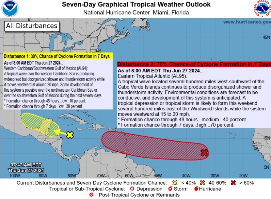
Florida - Thursday June 27, 2024: The National Hurricane Center (NHC) expects a tropical wave in the eastern Atlantic will become a tropical depression, if not a storm, by this weekend as it approaches the Windward Islands.
Right now it's given a 40% chance of formation within the next two days, and a 70% chance over the next week.
2. Eastern Tropical Atlantic: Invest 95-L:
Invest 95-L is located several hundred miles west-southwest of the Cabo Verde Islands in the eastern Atlantic. It continues to produce disorganized shower and thunderstorm activity. Environmental conditions are forecast to be conducive, and development of this system is anticipated.
A tropical depression or tropical storm is likely to form this weekend several hundred miles east of the Windward Islands while the system moves westward at 15 to 20 mph.
If it does become a tropical storm, it will be named Beryl, the second named storm of the season after Alberto.
* Formation chance through 48 hours...medium...40 percent.
* Formation chance through 7 days...high...70 percent.

2. Western Caribbean/Southwestern Gulf of Mexico - Invest 94-L:
Currently Invest 94-L is producing widespread but disorganized shower and thunderstorm activity while it moves westward at around 20 mph. Some development of this system is possible over the northwestern Caribbean Sea or over the southwestern Gulf of Mexico during the next several days.
While this tropical wave currently appears more menacing than the disturbance behind it, Invest 94-L is given a lower chance of development, just 10% over the next few days.
This disturbance is already in the Caribbean, south of Cuba. It's tracking towards the recently storm battered Yucatan Peninsula in Mexico. Over the next week it has only a 30% chance of becoming another storm.
* Formation chance through 48 hours...low...10 percent.
* Formation chance through 7 days...low...30 percent.


