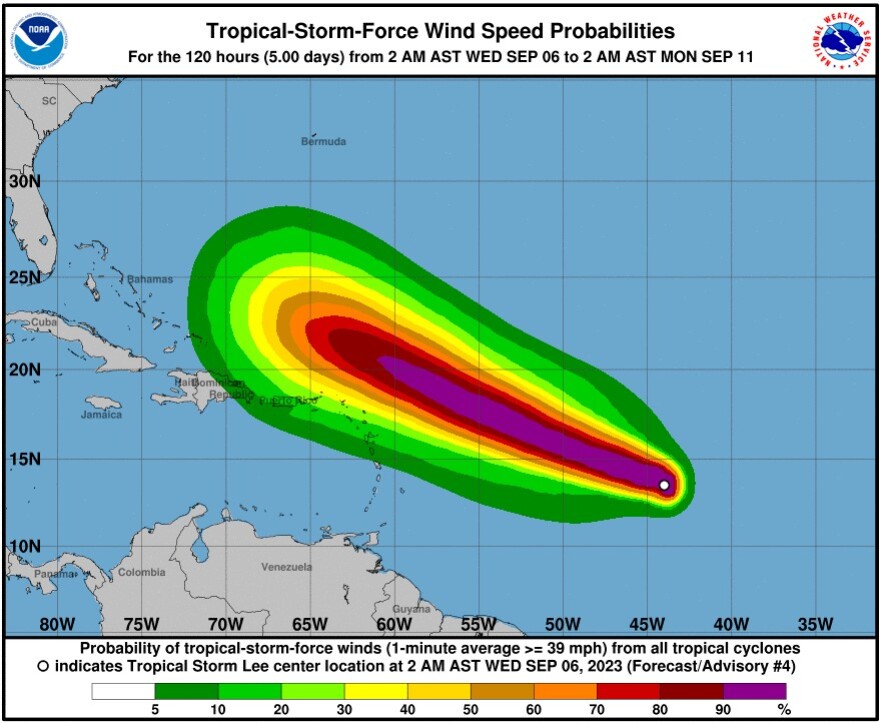

Florida - Wednesday September 6, 2023: The National Hurricane Center (NHC) predicts that Tropical Storm Lee will become a hurricane later today, and turn into an extremely dangerous major hurricane by Saturday.
The Hurricane Center has Lee on a path that takes it north of the Leeward Islands, where it is expected to create tropical storm conditions by Saturday. The NHC has not yet forecast a track after that.
However a number of models have it turning due north, into the central Atlantic, away from the U.S. mainland, after Lee passes to the north of Puerto Rico. That is still four to five days away, the path could change, and where Lee goes after passing the Leeward islands may not become clear until Monday.
Tropical Storm Lee as of 11 a.m. EST Wednesday September 6
At 11 am a.m. EST, the center of Tropical Storm Lee was located near latitude 14.1 north and longitude 45.5 west, about 1,200 miles east of the northern Leeward Islands
Lee was moving toward the west-northwest near 14 mph. It is expected to continue in that direction for the next few days, with a slight reduction in forward speed.
Maximum sustained winds have increased to near 70 mph, with higher gusts. Continued steady to rapid strengthening is forecast, and Lee is expected to become a hurricane later today and a major hurricane in a couple of days.
Tropical-storm-force winds extend outward up to 80 miles from the center.
The estimated minimum central pressure is 994 millibars or 29.36 inches.
Swells generated by Lee are expected to reach portions of the Lesser Antilles on Friday. These swells are likely to cause life-threatening surf and rip current conditions.


