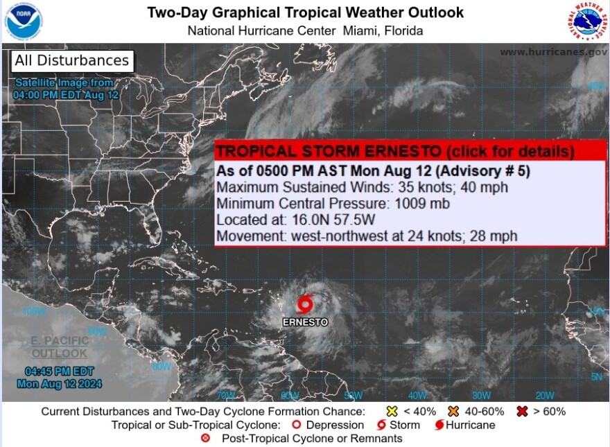

Florida - Monday August 8, 2024: Late Monday afternoon the National Hurricane Center (NHC) upgraded Potential Tropical Cyclone 5 to a tropical storm named Ernesto.
The storm is expected to bring tropical storm force winds and heavy rains to portions of the Leeward Islands by late Monday night. The National Hurricane Center still expects it to become a major hurricane in the vicinity of Bermuda by Saturday afternoon.
It's forecast to remain a tropical storm as it passes over the Virgin Islands, Puerto Rico, and the eastern tip of Hispaniola through Wednesday night, after which it will turn north and strengthen into a major hurricane by the time it reaches Bermuda on Saturday around 2 PM.
NHC - Tropical Storm Ernesto as of 5 PM Monday
Location: 16.0N 57.5W ... about 295 Miles ESE OF Antigua and about 590 miles ESE of San Juan Puerto Rico
Maximum Sustained Winds: .40 MPH
Present Movement: WNW or 285 degrees at 28 MPH
Minimum Central Pressure: 1009 MB or 29.80 inches
Watches and Warnings
A Tropical Storm Warning is in effect for...
* St. Kitts, Nevis, Montserrat, Antigua, Barbuda, and Anguilla
* Guadeloupe
* St. Martin and St. Barthelemy
* St Maarten
* British Virgin Islands
* U.S. Virgin Islands
* Puerto Rico
* Vieques
* Culebra
A Tropical Storm Warning means that tropical storm conditions are expected somewhere within the warning area within 36 hours.
Interests elsewhere in the northeastern Caribbean should monitor the progress of Ernesto.


