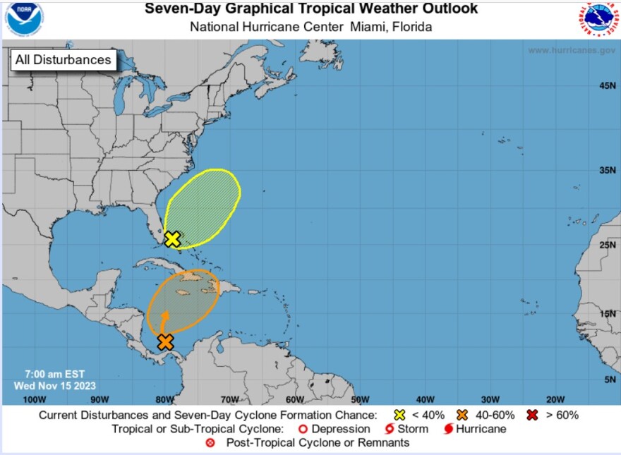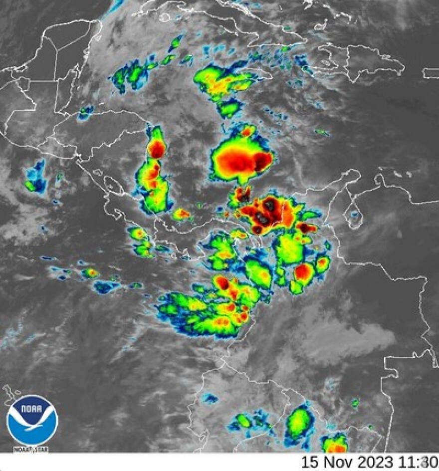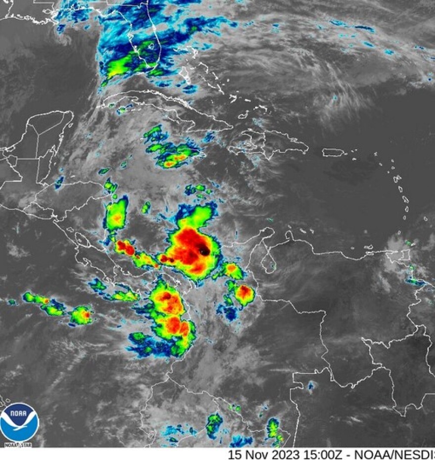
Florida - Wednesday November 15, 2023: The National Hurricane center is tracking two disturbances now, neither of which pose a direct threat at this time to Florida.
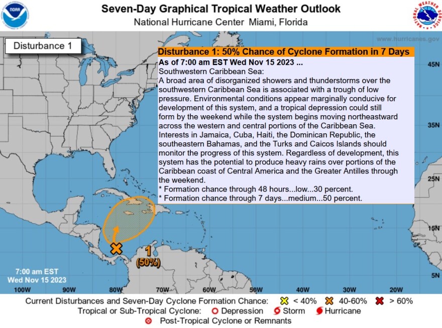
Southwestern Caribbean Sea

A broad area of disorganized showers and thunderstorms over the southwestern Caribbean Sea is associated with a trough of low pressure.
Environmental conditions appear marginally conducive for development of this system, and a tropical depression could still form by the weekend while the system begins moving northeastward across the western and central portions of the Caribbean Sea.
Interests in Jamaica, Cuba, Haiti, the Dominican Republic, the southeastern Bahamas, and the Turks and Caicos Islands should monitor the progress of this system.
Regardless of development, this system has the potential to produce heavy rains over portions of the Caribbean coast of Central America and the Greater Antilles through the weekend.
* Formation chance through 48 hours...low...30 percent.
* Formation chance through 7 days...medium...50 percent.

Offshore Southeast Coast of United States
A non-tropical area of low pressure is expected to develop near southern Florida along a surface trough over the next day or so.
This system is then forecast to move northeastward near the Bahamas and offshore of the east coast of the U.S. late this week and over the weekend.
Although development into a tropical cyclone appears unlikely, this system is expected to produce gusty winds and heavy rains across portions of southern Florida, the Florida Keys, and the Bahamas during the next couple of days.
For more information on this system, including gale warnings, see High Seas Forecasts issued by the National Weather Service.
* Formation chance through 48 hours...low...10 percent.

* Formation chance through 7 days...low...10 percent.

Offshore Southeast Coast of United States:
A non-tropical area of low pressure is expected to develop near
southern Florida along a surface trough over the next day or so.
This system is then forecast to move northeastward near the Bahamas
and offshore of the east coast of the U.S. late this week and over
the weekend. Although development into a tropical cyclone appears
unlikely, this system is expected to produce gusty winds and heavy
rains across portions of southern Florida, the Florida Keys, and the
Bahamas during the next couple of days. For more information on
this system, including gale warnings, see High Seas Forecasts issued
by the National Weather Service.
* Formation chance through 48 hours...low...10 percent.
* Formation chance through 7 days...low...10 percent.


