


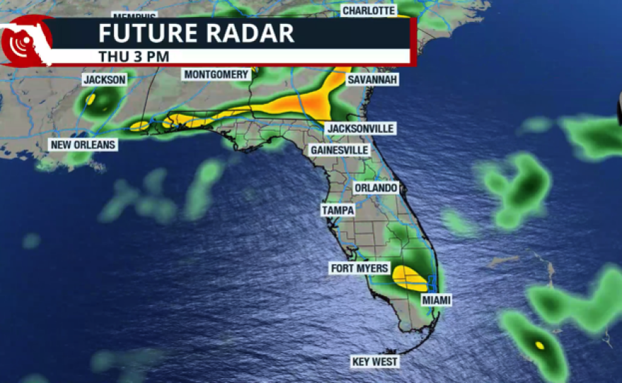
Severe weather is expected on Wednesday across the panhandle in parts of North Florida. At the same time, Thursday becomes a bit more active with isolated storms that could turn Severe across much of the peninsula.
A weak low-pressure system in the upper levels of the atmosphere is moving over the Southeast, just through the southern periphery of the high-pressure system that’s bringing extreme heat across the middle Atlantic and the northeast.

This low-pressure system will allow the moisture and the heat to finally interact, providing enough instability to get storms going. Some of the storms could turn severe. The main risk starts late afternoon on Wednesday and continues through the evening hours. There’s a slight risk for severe thunderstorms to push over the Panhandle with storms, mainly moving from northeast to southwest. Areas like Tallahassee through Pensacola could experience severe storms that could produce damaging winds of at least 60 mph and large hail.


The rest of the Peninsula will remain with seminar conditions as we’ve had the last few days. We continue to have a high-pressure system over the surface, bringing east to southeastern winds. The crossing low-pressure system will increase the thunderstorm activity across parts of South Florida for the first half of the day. Then, the storm activity could be mainly focused on the west coast, from the afternoon into the evening.
There’s a marginal risk for severe weather across much of the peninsula on Thursday afternoon. The winds could slow, allowing the sea to interact and keep the thunderstorms more generalized and spread over Florida.

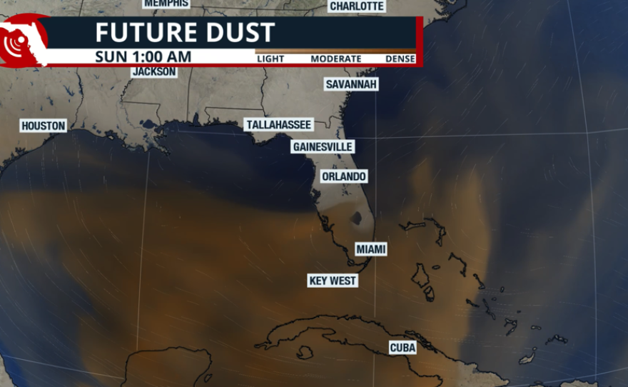

By the end of this week and through the weekend, there’s a chance for Saharan dust to make its way closer to Florida. Specifically, the Saharan dust model shows lower-than-average thunderstorm activity for the South and parts of Central Florida on Saturday and Sunday. Keep in mind that once the dry air and dust are present, dry air tends to suppress the chance for thunderstorm activity. There could still be a few isolated showers, but overall, there would be lower-than-average thunderstorm activity, but higher-than-average temperatures.