


The entire state of Florida is under a cold weather advisory or a freeze warning. Much of the Peninsula, from the Panhandle through the northern and western portions of Lake Okeechobee, is under a freeze warning that will remain in effect at least until 9 am on Friday.
The cold front pushed through North Florida and the Panhandle early Thursday and was through Central Florida, along the I-4 corridor, by 2 p.m. After its passage, the skies cleared and the winds picked up. Across South Florida at 5 p.m., the skies have mostly cleared, and winds are picking up. Temperatures are plummeting quickly, and once the sun sets, they will drop further.
Tonight will be one of the coldest nights we’ve seen in parts of the area in over 3 years with lows dipping into the 20s and 30s across most of the region away from the coast. Winds will make it feel even colder so if you have to be outdoors bundle up and dress in layers.🥶#FLwx pic.twitter.com/N187NQH74N
— NWS Tampa Bay (@NWSTampaBay) January 16, 2026
Temperature forecast
Across the Panhandle and North Florida, temperatures will be in the low 20s, and winds will be tapering off, but this cold will be dangerous for crops and for the most vulnerable populations, such as the homeless, children, and the elderly. It is also important to protect the plumbing tonight, as temperatures as low as 20ºF could last over 4 hours.
Central Florida will also experience sub-freezing temperatures. Freeze warnings are in effect for inland locations, but not the immediate central east coast or the edge of the Tampa Bay area. Keep in mind that it will still be cold in these areas, with strong gusts. Although temperatures will likely not drop below 32, it will feel in the upper 20s because the wind prevents freezing.
The advisories were simplified in 2024. So last time we had a cold advisory (P.K.A Windchill adv.) was in 2022 for SE Florida.
— Irene Sans (@IreneSans) January 15, 2026
2025 had a cold weather advisory, but only for inland Broward Co. pic.twitter.com/XYGmf8aqDx
Tonight will be the coldest night in over 3 years for much of South Florida. The last time the South Florida (Miami-Dade and Broward) metro areas were under a windchill advisory was in 2022.
If you have been out, you have already felt it. Cold Friday morning! Take care of kids, the elderly, plants, and pipes (if you are in North/Panhandle) pic.twitter.com/9BZDPR18Jp
— Florida Public Radio Emergency Network (FPREN) (@FloridaStorms) January 16, 2026
For how long?
Although temperatures will moderate slightly, we still expect them to remain below average statewide for this time of year. We will continue to be under a high-pressure system that will gradually shift the winds and diminished them but the cooler air mass will stay in place keeping the temperatures on Saturday around the upper 60s to lower 70s across south Florida, Central Florida will stay with temperatures in the afternoon in the 60s while Saturday morning will be another cold one by Sunday morning temperatures will stay around the mid to upper 40s.


One more cold front to reinforce the cold air.
The better news is that the cold air will likely remain in place at the start of next week. Another cold front will push through the state on Sunday, reinforcing the cold across Florida and keeping temperatures in the colder range on Monday. We’re not expecting a colder air mass than the one we’ll have on Friday, but temperatures will still be well below normal for this time of year.
The biggest news over the weekend is the possibility of a wintry mix in parts of the Panhandle. The air will remain cold, and any intrusion of cold air ahead of the moisture with the incoming storm system could develop a few flakes or perhaps some freezing rain. At the moment, it seems like it will be mostly all rain across the I-10 corridor. We will provide an update by early Saturday on the next system.
Don't put the jackets & boots away. Another cold front will bring another round of cold temps on Monday.
— Florida Public Radio Emergency Network (FPREN) (@FloridaStorms) January 16, 2026
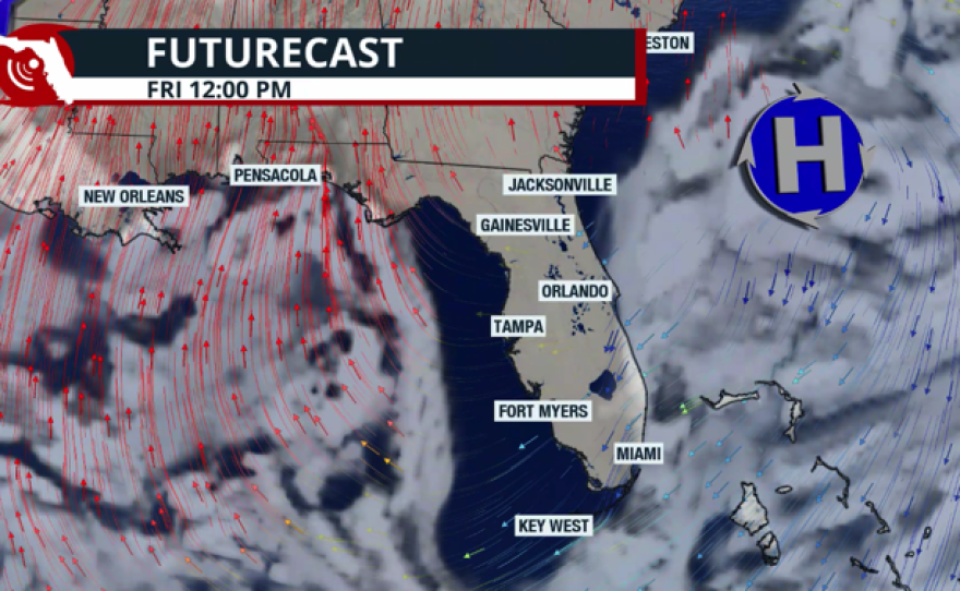
Rain-free on Friday.
Saturday will be mostly dry, but winds shift, and the next cold front will move into the Pahandle. We are monitoring for the chance of a wintry mix. pic.twitter.com/hAZQFurGvh
Highs on Monday could be 5 to 10° below average, with mid-60s across South Florida and mid- to upper 50s across Central Florida. North Florida and the Panhandle will wake up on Monday morning with temperatures in the upper 20s, and the sunshine will allow afternoon temperatures on Martin Luther King Day to reach the mid- to upper 50s.