


Fire danger will extend throughout the weekend and into next week, as humidity is expected to remain low and drought conditions persist at some of the worst levels on record.


On Saturday, relative humidity will not exceed 40%, but overall, it will be below 30% through the afternoon. This indicates very dry air in place. The ground remains exceptionally dry as well. There was no improvement in the drought monitor report released Thursday morning. The next front, which will cross the Panhandle on Sunday, does not promise much rain in areas that need it. Although there could be some showers early Sunday across Pensacola and Panama City Beach, rainfall will be very isolated as the front moves east.
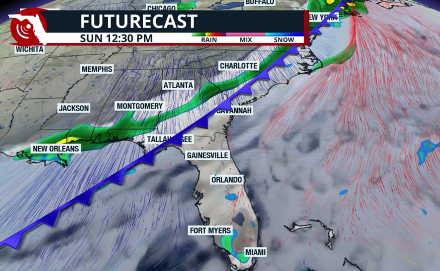

The concern between Sunday and Monday is that, following the cold front, winds will pick up, and with humidity remaining very low, any fires that start could spread quickly. Make sure to follow the burn bans in effect in your city and county. Winds will be from the north-northwest, with gusts up to 30 mph. Humidity will be lowest on Monday, dropping below 22%, with a likely Red Flag Warning going into effect.

While humidity will slowly rise through the middle and end of the week, it will remain relatively low. Winds will decrease starting Tuesday, but temperatures will rise. Tallahassee will see highs in the upper 80s on Saturday, in the low 80s on Sunday, and return to the upper 80s by Thursday.
A "dry" cold front pushing through Sunday will bring winds and very dry air behind, resulting in a dangerous combination of low humidity and gusty winds across the region where extreme #drought continues. Prevent wildfires – Don't be the spark! 🔥 #gawx #flwx pic.twitter.com/4BYLwehcUW
— NWS Jacksonville (@NWSJacksonville) April 17, 2026
Gainesville will experience a similar temperature pattern, ranging from the low 90s over the weekend to the low-to-mid 70s early in the week, and back to the 80s by the end of next week.

The following weather conditions will prompt the issuance of a Red Flag Warning:
- In North Florida (National Weather Service offices in Mobile, Tallahassee, and Jacksonville): relative humidity below 28 percent, wind speeds greater than 15 mph, and an Energy Release Component (Fuel Model G) of 26 or higher.
- In Peninsular Florida (National Weather Service offices in the Tampa Bay Area, Melbourne, Miami, and Key West): relative humidity below 35 percent, wind speeds greater than 15 mph, and an Energy Release Component (Fuel Model G) of 27 or higher.
Wildfire Information
Between 1992 and 2013, five out of six wildfires in the U.S. were caused by humans. Once a fire starts—whether from human activity or natural causes—weather conditions determine its potential spread and rate of growth. Understanding fire weather conditions and maintaining local areas to prevent fire spread and protect structures and lives is crucial.

The dry season is ongoing, and we are approaching the peak of wildfire season, which occurs year-round in Florida. Authorities have already warned that this peak could bring increased wildfire activity. While it is impossible to predict where a wildfire will ignite, we are all responsible for helping to prevent them.
On average, the Florida Forest Service conducts prescribed burns on more than 2 million acres annually to manage the land and reduce the risk of future wildfires.