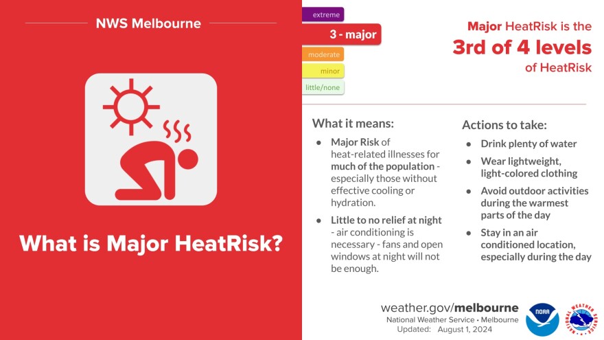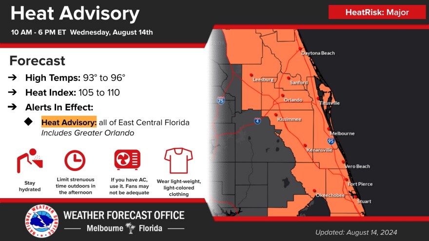

East-Central Florida - Wednesday August 14, 2024: The National Weather Service in Melbourne has issued a Heat Advisory today for all of East-Central Florida. Peak heat index values, or feel like temperatures, are forecast to range from 105-110F degrees. That poses a Major Heat Risk.
A Major Heat Risk means that temperatures in this range affect anyone without effective cooling or adequate hydration.
If you plan on spending any time outside, stay hydrated and drink plenty of fluids. Take frequent breaks out of the sun, preferably in an air conditioned building. Check up on relatives and neighbors.
Some relief may come this afternoon when scattered to numerous afternoon showers and storms are forecast as a surface boundary front moves southward. "Cooler" and drier conditions will finally begin to build on Friday behind the front.
NWS MELBOURNE - HEAT ADVISORY
- WHAT: Heat index values up to 110 expected.
- WHERE: Coastal Indian River, Coastal Martin, Coastal Saint Lucie, Coastal Volusia, Inland Indian River, Inland Martin, Inland Northern Brevard, Inland Saint Lucie, Inland Southern Brevard, Inland Volusia, Mainland Northern Brevard, Mainland Southern Brevard, Northern Brevard Barrier Islands, Northern Lake, Okeechobee, Orange, Osceola, Seminole, Southern Brevard Barrier Islands, and Southern Lake.
- WHEN: From 10 AM this morning to 6 PM EDT this evening.
- IMPACTS: Hot temperatures and high humidity may cause heat illnesses.

Hazardous Weather Outlook for East-Central Florida
EXCESSIVE HEAT IMPACT
High temperatures in the mid 90s combined with muggy conditions will produce peak heat index values between 106-110 degrees. A Heat Advisory is in effect for all of east central Florida today.
THUNDERSTORM IMPACT
Scattered to numerous showers and scattered lightning storms are forecast across east central Florida this afternoon. Any stronger storms which develop will be capable of occasional to frequent lightning strikes, wind gusts up to 50 mph, and locally heavy rainfall.
Warm and muggy conditions with afternoon storms continue Thursday. A drier airmass builds on Friday providing some relief from the heat and reducing storm chances into the weekend.
WIND and SEA IMPACT
Incoming long period swells beginning Thursday night and continuing this weekend will produce rough surf and a High risk of rip currents. Building seas will produce hazardous small craft conditions offshore. Small craft may also experience hazardous conditions near inlets especially during the outgoing tide.


